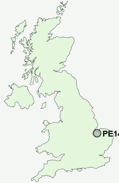
Postcode : PE14 7, Norfolk
Postcodes in the PE14 7 district. Covering areas such as St John's Highway, West Walton, Walpole Marsh, Wash Dyke, Walpole St Andrew, Ingleborough, Church End, Walton Highway, Ratten Row, Terrington St John, Walpole St Peter, Walpole Highway and Norfolk.
Postcode Area PE : Peterborough
PE14 Postcode Sectors
PE14 0 Begdale, Coldham, Collett's Br, Elm, Friday Bridge
PE14 8 Chequers Corner, Emneth, Emneth Hungate, Holly End, Marshland St James
PE14 8 Chequers Corner, Emneth, Emneth Hungate, Holly End, Marshland St James
PE14 9 Christchurch, Iron Bridge, Suspension Bridge, Three Holes, Tipps End
PE14 7 Church End, Ingleborough, Ratten Row, St John's Highway, Terrington St John
PE14 7 Church End, Ingleborough, Ratten Row, St John's Highway, Terrington St John
PE14 7 Nearby Postcode Districts
PE14 7 Schools
West Walton Community Primary SchoolMarshland High School
Orchards Church of England Primary School
UK Search
Antique Furniture
1000s of pieces of Antique Furniture for sale from British antique dealers.