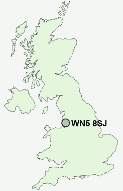
Postcode : WN5 8SJ, Billinge, Wigan, Merseyside
Moor Road, Orrell, Wigan.
WN5 8SJ close to Far Moor, Orrell Post, Tontine, Higher End, Orrell and Lamberhead Green.
Classification
WN5 8SJ : Hard-pressed living / Hard pressed ageing workers / Ageing industrious workers
Local Authority Wigan
Primary Care Trust Ashton, Leigh and Wigan
Ward Orrell
Constituency Makerfield
Region North West
Country England
Postcode Area WN : Wigan
WN5 Postcode Sectors
WN5 7 Billinge, Brownlow, Chadwick Green, Higher End, Laffak
WN5 8 Far Moor, Lamberhead Green, Orrell, Orrell Post, Tontine
WN5 8 Far Moor, Lamberhead Green, Orrell, Orrell Post, Tontine
WN5 8SJ Nearby Postcode Districts
BL1 BL2 BL3 BL4 BL5 BL6 BL7 BL8 L10 L11 L12 L20 L21 L22 L23 L28 L29 L30 L31 L32 L33 L34 L37 L38 L39 L4 L40 L9 M17 M26 M27 M28 M29 M30 M38 M41 M44 M46 PR8 WA10 WA11 WA12 WA3 WA9 WN1 WN2 WN3 WN4 WN5 WN6 WN7 WN8
Stations near to WN5 8SJ
Orrell Rail Station about 0.29 miles away.Upholland Rail Station about 1.36 miles away.
Pemberton Rail Station about 1.65 miles away.
Gathurst Rail Station about 1.83 miles away.
Appley Bridge Rail Station about 3.07 miles away.
Garswood Rail Station about 3.53 miles away.
WN5 8SJ Schools
Orrell Holgate Primary SchoolUp Holland High School
Orrell Newfold Community Primary School
Abraham Guest High School
Orrell Lamberhead Green Community Primary School
PEMBEC High School
Westfield Community School
Moorside Community Primary School
Marsh Green Primary School
Winstanley Community Primary School
UK Search
Antique Furniture
1000s of pieces of Antique Furniture for sale from British antique dealers.