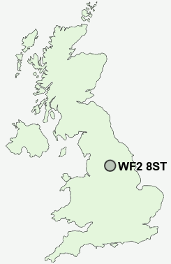
Postcode : WF2 8ST, Wakefield, West Yorkshire
Lawefield Lane, Wakefield, West Yorkshire.
WF2 8ST close to Thornes, Flanshaw, Lupset and Alverthorpe.
Classification
WF2 8ST : Multicultural metropolitans / Challenged Asian terraces / Pakistani communities
Local Authority Wakefield
Primary Care Trust Wakefield District
Ward Wakefield West
Constituency Wakefield
Region Yorkshire and The Humber
Country England
Postcode Area WF : Wakefield
WF2 Postcode Sectors
WF2 0 Alverthorpe, Beck Bottom, Brandy Carr, Carr Gate, Jaw Hill
WF2 7 Durkar, Kettlethorpe, Milnthorpe, Portobello, Sandal
WF2 9 Flanshaw
WF2 7 Durkar, Kettlethorpe, Milnthorpe, Portobello, Sandal
WF2 9 Flanshaw
WF2 8ST Nearby Postcode Districts
BD11 BD12 BD19 BD4 BD5 BD6 DN6 HD1 HD2 HD3 HD4 HD5 HD6 HD7 HD8 HD9 HX1 HX2 HX3 HX4 HX5 LS10 LS11 LS26 LS27 WF1 WF10 WF11 WF12 WF13 WF14 WF15 WF16 WF17 WF2 WF3 WF4 WF5 WF6 WF7 WF8 WF9
Stations near to WF2 8ST
Wakefield Westgate Rail Station about 0.34 miles away.Wakefield Kirkgate Rail Station about 0.87 miles away.
Sandal & Agbrigg Rail Station about 1.59 miles away.
Outwood Rail Station about 2.53 miles away.
WF2 8ST Schools
The Mount Junior Infant & Nursery SchoolWakefield Flanshaw Junior and Infant School
Wakefield Pinders Primary (JIN) School
Wakefield Snapethorpe Primary School
Wakefield Sandal Magna Junior and Infants School
Wakefield City High School - A Specialist Maths and Computing College
Wrenthorpe Primary School
Stanley Wrenthorpe Jerry Clay Lane Junior and Infant School
UK Search
Antique Furniture
1000s of pieces of Antique Furniture for sale from British antique dealers.