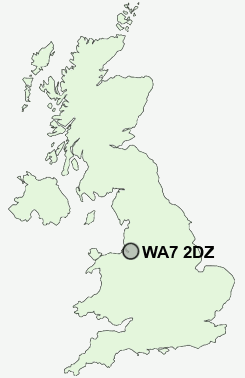
Postcode : WA7 2DZ, Runcorn, Halton, Cheshire
Halton Brook, Runcorn.
WA7 2DZ close to Grange, Halton, Halton Brook, Castlefields, Beechwood and Higher Runcorn.
Classification
WA7 2DZ : Hard-pressed living / Migration and churn / Young hard-pressed families
Local Authority Halton
Primary Care Trust Halton and St Helens
Ward Halton Brook
Constituency Halton
Region North West
Country England
Postcode Area WA : Warrington
WA7 Postcode Sectors
WA7 1 Astmoor, West Bank
WA7 3 Aston, Aston Heath, Preston Brook, Sutton Weaver
WA7 2 Beechwood, Castlefields, Halton
WA7 3 Aston, Aston Heath, Preston Brook, Sutton Weaver
WA7 2 Beechwood, Castlefields, Halton
WA7 6 Brookvale, Murdishaw, Windmill Hill
WA7 4 Clifton, Heath, Rocksavage, Weston Point, Weston Village
WA7 5 Grange, Halton Brook, Higher Runcorn, Runcorn
WA7 4 Clifton, Heath, Rocksavage, Weston Point, Weston Village
WA7 5 Grange, Halton Brook, Higher Runcorn, Runcorn
WA7 2DZ Nearby Postcode Districts
CH41 CH42 CH43 CH44 CH45 CH49 CH60 CH61 CH62 CH63 CH64 CH65 CH66 CW8 CW9 L1 L13 L14 L15 L16 L17 L18 L19 L2 L24 L25 L26 L27 L3 L35 L36 L5 L6 L69 L7 L70 L8 M31 M33 WA1 WA13 WA14 WA15 WA16 WA2 WA4 WA5 WA6 WA7 WA8
Stations near to WA7 2DZ
Runcorn Rail Station about 1.37 miles away.Runcorn East Rail Station about 1.77 miles away.
Frodsham Rail Station about 2.61 miles away.
Widnes Rail Station about 3.36 miles away.
WA7 2DZ Schools
The Grange SchoolHalton Lodge Primary School
Hallwood Park Primary School and Nursery
Astmoor Primary School
The Heath School
Pewithall Primary School
The Park Primary School
Hillview Primary School
Westfield Primary School
West Bank Primary School
UK Search
Antique Furniture
1000s of pieces of Antique Furniture for sale from British antique dealers.