Postcode : TN25 6BE, Stowting, Kent
Stowting, Ashford, Kent.
TN25 6BE close to Stowting, Stowting Court, Lymbridge Green, Stowting Common and Pett Bottom.
Classification
TN25 6BE : Rural residents / Farming communities / Established farming communities
Local Authority Shepway
Primary Care Trust Eastern and Coastal Kent
Ward North Downs West
Constituency Folkestone and Hythe
Region South East
Country England
Postcode Area TN : Tonbridge
TN25 Postcode Sectors
TN25 7 Aldington, Aldington Frith, Bilsington, Bliby, Bonnington
TN25 6 Barrowhill, Brabourne Lees, Broad Street, Lilyvale, Lymbridge Green
TN25 6 Barrowhill, Brabourne Lees, Broad Street, Lilyvale, Lymbridge Green
TN25 4 Bilting, Boughton Aluph, Boughton Corner, Boughton Lees, Challock
TN25 5 Bircholt Forstal, Bodsham, Brabourne, Brook, Elmsted
TN25 5 Bircholt Forstal, Bodsham, Brabourne, Brook, Elmsted
TN25 6BE Nearby Postcode Districts
CT14 CT15 CT16 CT17 CT18 CT19 CT20 CT21 CT4 TN23 TN24 TN25 TN26 TN27 TN30
Stations near to TN25 6BE
Westenhanger Rail Station about 3.08 miles away.Sandling Rail Station about 3.65 miles away.
TN25 6BE Schools
Stowting Church of England Primary School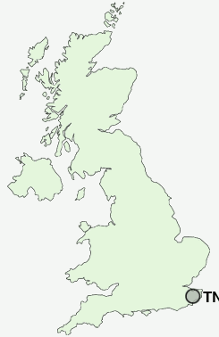
UK Search
Antique Furniture
1000s of pieces of Antique Furniture for sale from British antique dealers.