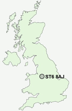
Postcode : ST6 8AJ, Ball Green, Stoke-on-Trent, Staffordshire
Whitfield Road, Stoke-on-Trent.
ST6 8AJ close to Ball Green, Cornhill, Bradeley, Ridgeway, Chell Heath and Little Chell.
Classification
ST6 8AJ : Rural residents / Rural tenants / Rural life
Local Authority Stoke-on-Trent
Primary Care Trust Stoke on Trent
Ward Baddeley, Milton and Norton
Constituency Stoke-on-Trent North
Region West Midlands
Country England
Postcode Area ST : Stoke on Trent
ST6 Postcode Sectors
ST6 8 Ball Green, Brown Edge, Cornhill, Hodgefield, Norton Green
ST6 7 Bank Top, Bradeley, Stanfield
ST6 2 Burslem
ST6 4 Chatterley, Longbridge Hayes, Longport, Ravenscliffe
ST6 7 Bank Top, Bradeley, Stanfield
ST6 2 Burslem
ST6 4 Chatterley, Longbridge Hayes, Longport, Ravenscliffe
ST6 6 Chell Heath, Fegg Hayes, Great Chell, Little Chell, Oxford
ST6 1 Ford Green, Smallthorne
ST6 5 Goldenhill, Newfield, Sandyford
ST6 3 Middleport
ST6 1 Ford Green, Smallthorne
ST6 5 Goldenhill, Newfield, Sandyford
ST6 3 Middleport
ST6 8AJ Nearby Postcode Districts
CW1 CW11 CW12 CW2 CW3 CW5 ST1 ST10 ST13 ST2 ST3 ST4 ST5 ST6 ST7 ST8 ST9
Stations near to ST6 8AJ
Longport Rail Station about 2.75 miles away.ST6 8AJ Schools
Smallthorne Primary SchoolNew Ford Primary School
Jackfield Infant School
Moorpark Junior School
Packmoor Primary School
Hillside Primary School
Milton Primary School
UK Search
Antique Furniture
1000s of pieces of Antique Furniture for sale from British antique dealers.