Postcode : LS25 6QN, Garforth, Leeds, West Yorkshire
West View, Sherburn in Elmet, Leeds.
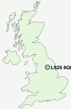
LS25 6QN close to Sherburn in Elmet and South Milford.
Classification
LS25 6QN : Hard-pressed living / Industrious communities / Industrious transitions
Local Authority Selby
Primary Care Trust North Yorkshire and York
Ward Sherburn in Elmet
Constituency Selby and Ainsty
Region Yorkshire and The Humber
Country England
Postcode Area LS : Leeds
LS25 Postcode Sectors
LS25 3 Aberford, Green Hill, Parlington, St John's
LS25 6 Biggin, Little Fenton, Newthorpe, Sherburn in Elmet
LS25 5 Burton Salmon, Hillam, Ledsham, Lumby, Monk Fryston
LS25 2 East Garforth, Garforth
LS25 6 Biggin, Little Fenton, Newthorpe, Sherburn in Elmet
LS25 5 Burton Salmon, Hillam, Ledsham, Lumby, Monk Fryston
LS25 2 East Garforth, Garforth
LS25 4 Garden Village, Micklefield, New Micklefield, Old Micklefield
LS25 7 Kippax, Ledston Luck
LS25 1 West Garforth
LS25 7 Kippax, Ledston Luck
LS25 1 West Garforth
LS25 6QN Nearby Postcode Districts
DN14 LS1 LS10 LS11 LS12 LS13 LS14 LS15 LS16 LS17 LS18 LS2 LS24 LS25 LS26 LS27 LS3 LS4 LS5 LS6 LS7 LS8 LS9 WF10 WF11 WF13 WF17 WF3 WF6 YO8
Stations near to LS25 6QN
South Milford Rail Station about 0.4 miles away.Sherburn-in-Elmet Rail Station about 0.99 miles away.
Church Fenton Rail Station about 2.83 miles away.
LS25 6QN Schools
Sherburn in Elmet, Athelstan Community Primary SchoolSherburn High School
Sherburn Hungate Community Primary School
South Milford Community Primary School
UK Search
Antique Jewellery
including Antique Engagement Rings for sale from UK Antique specialists.