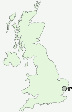
Postcode : IP2 8PY, Diss, Suffolk, Norfolk
Prince of Wales Drive, Ipswich.
IP2 8PY close to Watton, Maidenhall, Stoke Park, Stoke and Chantry.
Classification
IP2 8PY : Constrained city dwellers / Challenged diversity / Hampered aspiration
Local Authority Ipswich
Primary Care Trust Suffolk
Ward Bridge
Constituency Ipswich
Region Eastern
Country England
Postcode Area IP : Ipswich
IP2 Postcode Sectors
IP2 8PY Nearby Postcode Districts
CO8 IP1 IP10 IP11 IP12 IP2 IP3 IP4 IP5 IP6 IP7 IP8 IP9
Stations near to IP2 8PY
Ipswich Rail Station about 0.56 miles away.Derby Road (Ipswich) Rail Station about 1.74 miles away.
Westerfield Rail Station about 2.82 miles away.
IP2 8PY Schools
Hillside Community Primary SchoolThe Oaks Community Primary School
Ranelagh Primary School
Cliff Lane Primary School
St Helen's Primary School
Handford Hall Primary School
Clifford Road Primary School
Morland Primary School
Rose Hill Primary School
Springfield Junior School
UK Search
Antique Jewellery
including Antique Engagement Rings for sale from UK Antique specialists.