Postcode : HP3 8JH, Bennetts End, Hertfordshire
Hill Common, Hemel Hempstead.
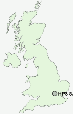
HP3 8JH close to Bennetts End, Nash Mills, Rucklers Lane and Leverstock Green.
Classification
HP3 8JH : Hard-pressed living / Migration and churn / Hard-pressed ethnic mix
Local Authority Dacorum
Primary Care Trust Hertfordshire
Ward Leverstock Green
Constituency Hemel Hempstead
Region Eastern
Country England
Postcode Area HP : Hemel Hempstead
HP3 Postcode Sectors
HP3 9 Apsley, Bennetts End, Nash Mills, Rucklers Lane, Two Waters
HP3 0 Bovingdon, Bovingdon Green, Flaunden, Hogpits Bottom, Venus Hill
HP3 0 Bovingdon, Bovingdon Green, Flaunden, Hogpits Bottom, Venus Hill
HP3 8JH Nearby Postcode Districts
AL1 AL10 AL2 AL3 AL4 AL5 AL6 AL7 AL8 AL9 EN1 EN2 EN4 EN5 EN6 EN7 HP1 HP14 HP15 HP16 HP19 HP2 HP20 HP21 HP22 HP23 HP27 HP3 HP4 HP5 HP6 HP7 HP8 SG13 SG14 WD1 WD17 WD18 WD2 WD23 WD24 WD25 WD3 WD4 WD5 WD6 WD7
Stations near to HP3 8JH
Apsley Rail Station about 0.82 miles away.Hemel Hempstead Rail Station about 1.92 miles away.
Kings Langley Rail Station about 2.24 miles away.
HP3 8JH Schools
Longdean SchoolBelswains Primary School
Hobbs Hill Wood Primary School
Lime Walk Primary School
Adeyfield School
The Hemel Hempstead School
Kings Langley School
Bedmond Village Primary and Nursery School
UK Search
Antique Jewellery
including Antique Engagement Rings for sale from UK Antique specialists.