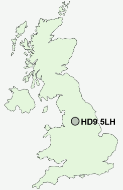
Postcode : HD9 5LH, Holmfirth, Kirklees, West Yorkshire
Birmingham Lane, Meltham, Holmfirth.
HD9 5LH close to Helme, Meltham, Crosland Edge, Meltham Mills and Thick Hollins.
Classification
HD9 5LH : Hard-pressed living / Hard pressed ageing workers / Ageing industrious workers
Local Authority Kirklees
Primary Care Trust Kirklees
Ward Holme Valley North
Constituency Colne Valley
Region Yorkshire and The Humber
Country England
Postcode Area HD : Huddersfield
HD9 Postcode Sectors
HD9 2 Arrunden, Burnlee, Cartworth, Flush House, Hade Edge
HD9 7 Barnside, Fulstone, Jackson Bridge, Maythorn, New Mill
HD9 6 Brockholes, Honley, Honley Moor, Oldfield, Scotgate
HD9 5 Crosland Edge, Helme, Meltham
HD9 7 Barnside, Fulstone, Jackson Bridge, Maythorn, New Mill
HD9 6 Brockholes, Honley, Honley Moor, Oldfield, Scotgate
HD9 5 Crosland Edge, Helme, Meltham
HD9 1 Hepworth, Holmfirth, Totties, Wooldale
HD9 4 Meltham Mills, Thick Hollins, Wilshaw
HD9 3 Netherthong, Upperthong
HD9 4 Meltham Mills, Thick Hollins, Wilshaw
HD9 3 Netherthong, Upperthong
HD9 5LH Nearby Postcode Districts
HD1 HD2 HD3 HD4 HD5 HD7 HD8 HD9 HX4 HX5 M24 M35 M40 M7 M8 M9 OL1 OL10 OL11 OL12 OL15 OL16 OL2 OL3 OL4 OL5 OL8 OL9 S36 S70 S75 WF1 WF12 WF13 WF14 WF2 WF4 WF5
Stations near to HD9 5LH
Slaithwaite Rail Station about 2.12 miles away.HD9 5LH Schools
Meltham Moor Primary SchoolMeltham CofE (VC) Primary School
Helme Church of England Voluntary Aided Junior and Infant School
Linthwaite Clough J I & Early Years Unit
Nields Junior Infant and Nursery School
UK Search
Antique Jewellery
including Antique Engagement Rings for sale from UK Antique specialists.