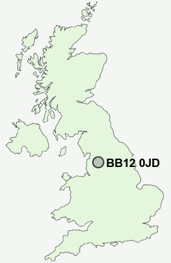
Postcode : BB12 0JD, Padiham, Lancashire
Wellfield Drive, Burnley.
BB12 0JD close to Habergham, Lowerhouse and Rose Grove.
Classification
BB12 0JD : Suburbanites / Suburban achievers / Comfortable suburbia
Local Authority Burnley
Primary Care Trust East Lancashire Teaching
Ward Whittlefield with Ightenhill
Constituency Burnley
Region North West
Country England
Postcode Area BB : Blackburn
BB12 Postcode Sectors
BB12 0JD Nearby Postcode Districts
BB1 BB10 BB11 BB12 BB2 BB3 BB4 BB5 BB6 BB7 BB8 BB9 BD20 BD21 BD22 HX1 HX2 HX6 HX7 OL13 OL14 PR5
Stations near to BB12 0JD
Burnley Barracks Rail Station about 0.51 miles away.Burnley Central Rail Station about 0.81 miles away.
Burnley Manchester Road Rail Station about 1.06 miles away.
Rose Grove Rail Station about 1.11 miles away.
Brierfield Rail Station about 2.13 miles away.
Nelson Rail Station about 3.29 miles away.
BB12 0JD Schools
Whittlefield Primary SchoolBurnley Ightenhill Primary School
Burnley Stoneyholme Community Primary School
Rosegrove Infant School
Burnley Lowerhouse Junior School
Thomas Whitham Sixth Form
Barden Primary School
Hameldon Community College
Burnley Heasandford Primary School
Shuttleworth College
UK Search
Antique Clocks
Browse Antique Clocks for sale from British antique dealers.